All-In-One Offline Maps
7.0M5,000,000+
地図&ナビ
4.4
All-In-One Offline Maps
広告なし 〜 データの現金化なし 〜 分析なし 〜 サードパーティのライブラリなし
地図表示の遅さにうんざりしていませんか? 「オールインワン・オフライン・マップ」機能を使えば 一度表示されると地図が記憶され、例え通信圏外でも即座に使えるようになります。
• 地図に載っている道以外が必要ですか? 必要なものがここで見られます;
• 通信事情の悪い場所に行くことがありますか? すべて使えるようになります;
• 海外に行くことがありますか? 今までのように道に迷うことはないでしょう;
• 通信データ容量の制約がありますか? 使用量を減らすことができます。
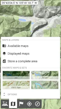
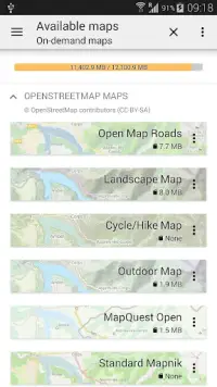
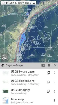
★★ 地図 ★★
多くの地図が利用可能で、古い道路地図、地形図、衛星地図に加え、地図に重ねられる様々なレイヤー、則ちオープンストリートマップ(道路、地形)、USGS全国地図(Hi-res topo、Aerial imagery)、世界軍事ソビエト地形図などが含まれます;
• すべての地図はレイヤーとして正確な透明度をもって重ねることができます;
• クリック数回で広範囲を指定し保存します;
• 記憶スペースがすぐ分かり簡単に削除できます。
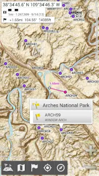
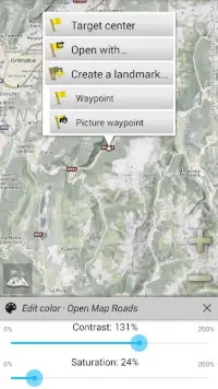
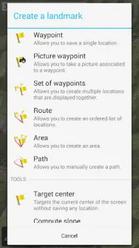
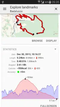
★★ プレイスマークが無制限に表示、保存、再生できます ★★
地図上に経過地、アイコン、ルート、領域および軌跡を追加できます;
それらを、強力な「SDカード プレイスマーク エクスプローラー」を用いて容易に管理できます。
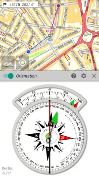
★★ 地図上のGPS測位およびルート検索 ★★
実際の位置や方角が地図上に明示され、実際の探索方向に合わせて回転させることができます (端末の性能に依存);
節電機能のオンオフ切り換え。
さらには:
• 各種距離単位の選択;
• GPS緯度経度および座標形式対応 (UTM、MGRS、USNG、OSGB、SK42、Lambert、QTH Maidenhead Locator System、等);
• 各種座標方式読み込み対応 https://www.spatialreference.org;
• 地図への格子線表示;
• 全画面表示;
• 画面タッチによる拡大縮小;
• 等
★★ さらなる必要? ★★
本格的な冒険家の方は、AlpineQuestのオフロードエクスプローラーをお試しください。「オールインワン・オフライン地図」に基づく、強力なGPS位置追跡などを搭載した野外活動の完璧な解決策です: https://www.alpinequest.net/google-play
もっと見せる
新着情報
version 3.15
The complete list is available in the changelog inside the application.
3.15
• Added ability to display arrows, distances and ETE along the real-time location and compass heading lines;
• Added duration estimation of drawn paths and routes based on the selected activity, with time estimations of each route legs displayed on the map;
• Added new fields in the Explorer mode: North and target direction arrows;
• Added new imperial distance unit using meters instead of feet;
• And more
情報
- ID:net.psyberia.offlinemaps
- カテゴリー:地図&ナビ
- 更新しました:2024-04-22
- バージョン:3.15
- 必要です:Android 2.1
- 上で利用可能:Google Play
- ファイルサイズ:7.0M
あなたも好きかも
- Yandex Go — taxi and delivery4.8106.2M
- Метро Москвы – метро, МЦД, МЦК3.3127.3M
- Uber Lite4.312.0M
- Bolt: Request a Ride4.752.8M
- Sygic GPS Navigation & Maps4.398.6M
- Cabify3.7106.2M
- Chalo - Live Bus Tracking App4.029.0M
- inDriver — Better than a taxi4.733.2M
- GPS, Maps, Navigate, Traffic &4.218.6M
- Яндекс Метро4.745.8M
- Pathao4.779.8M
- Jugnoo - Taxi Booking App & So4.333.8M
- DiDi – Greater China2.683.5M
- Grab Driver: App for Partners4.2235.6M
- HERE WeGo: Maps & Navigation3.455.8M